
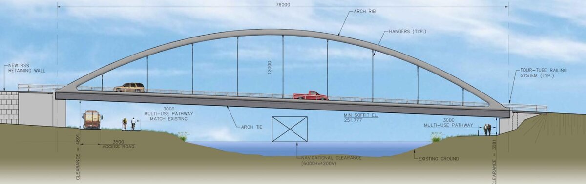
Colborne Street has been on Lindsay's map since 1834. For generations, it has approached the Scugog River from both directions without crossing it.
That is finally changing.
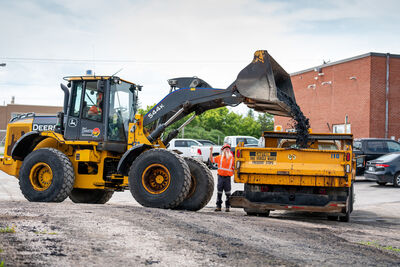
On Oct. 5, crews began preparing for a new bridge connecting Colborne Street West and East. Fall preparations include moving a watermain, building an access road and clearing a property near William Street North. Main bridge construction is scheduled to begin in 2027 and continue into 2028.
The 77-metre bridge will carry two traffic lanes and sidewalks beneath a steel arch, without a permanent pier in the river.
But behind those 77 metres lie more than 60 years of planning, neighbourhood concerns, changing governments and arguments about what kind of town Lindsay should become.
A street waiting for its bridge
Surveyor John Huston included Colborne Street in his 1834 plan for Lindsay, a 400-acre townsite beside the Scugog. The street was named for Sir John Colborne, then lieutenant-governor of Upper Canada.
The river helped build Lindsay. William Purdy and his sons established mills beside it before the town survey. Water power drew industry, jobs and residents, but the same river that helped the community grow made moving across town difficult.
By the 1960s, local planners identified the need for another crossing. They designed a Colborne route across the Scugog but lacked funding. More studies followed in the 1970s and 1980s.
In 1994, Victoria County completed an environmental assessment and selected Colborne. Improvements to the existing Wellington Street crossing were completed in 1995, with the new bridge to follow once traffic grew.
It didn't. An updated assessment followed in 2000, but funding was still unavailable. Amalgamation in 2001 brought Lindsay and Victoria County into the new City of Kawartha Lakes, which inherited the plan without building the bridge.
The debate on Colborne
The delay wasn't just about engineering or money. Residents had a stake in the outcome.
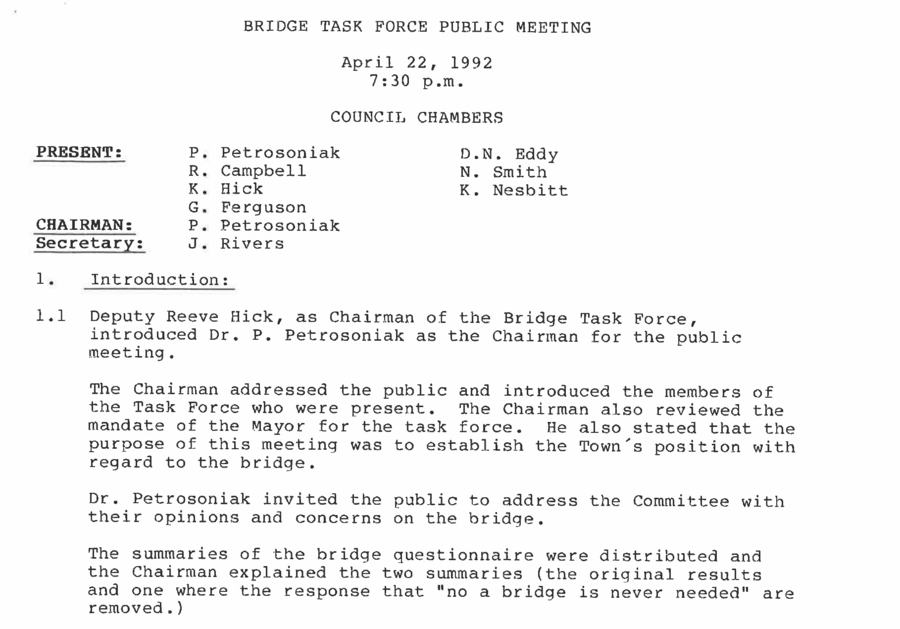
Minutes from a 1992 Lindsay bridge task force, recently provided by city archives, reveal a divided community.
At a February meeting, police chief Randy Martin considered Colborne the most economical route, though he preferred a crossing farther north for police planning. Fire chief Robert Lindsay took the opposite view: a northern crossing would be less useful for emergencies in the industrial district.
At an April public meeting, Ivan Drury of Colborne Street West said cars already travelled so fast that neighbours feared walking along the road. Gayle Dagneault noted that leaving her driveway took longer than waiting at Wellington Street. Others worried about safety, noise, pollution, higher taxes and changes to the waterfront.
Several speakers favoured a northern route. The meeting summary acknowledged Lindsay's need for another crossing but warned that a Colborne bridge could disrupt residential neighbourhoods and their social fabric.
Those concerns never vanished. In February 2026, resident Nancy Kelley presented council with a petition bearing 123 signatures asking it to reconsider the location.
The bridge also brings a visible loss: the former McAlpine home at 4 Colborne St. W. Built between 1882 and 1884, the brick house served as the home and medical practice of Dr. John McAlpine, Lindsay's first medical officer of health, from 1884 to 1925. Later converted into apartments, the building was identified as historically significant in a 2026 city heritage study, which recommended photographs and public displays to preserve its history after demolition. Local historian Ian McKechnie has also explored the property's history in The Lindsay Advocate.
A new crossing could shorten trips across town. But for neighbours along a street that has never carried cross-river traffic, it means giving up something familiar. A change that looks small on a map can feel enormous outside someone's front door.
Why this bridge, in this place?
In 2012, council requested another review of northern alternatives. Consultants examined two possible crossings near Thunder Bridge Road: one linking Thunder Bridge Road with Lagoon Road, the other using a former railway corridor farther south.
Both faced major obstacles. Environmentally sensitive wetlands would require longer structures and additional connecting roads. Consultants also concluded that a northern crossing would attract too little traffic to relieve congestion farther south.
The northern alternatives were estimated at $45 million to $75 million, compared with $5 million to $9 million for Colborne at the time.
The study favoured Colborne to address existing traffic needs. A 2015 city report identified another northern crossing as a possible need beyond 2031. The decision wasn't necessarily about choosing one bridge forever but deciding which crossing Lindsay needed first.
What changes for residents?
Once open, the bridge will let drivers follow Colborne from Highway 35 across the Scugog toward Kawartha Lakes Road 36, offering another cross-town route and relieving pressure on Wellington Street.
The bridge is part of a larger transportation corridor. West of the river, the city has begun widening Colborne Street to four lanes between Highway 35 and Charles Street. The first phase is complete, with further reconstruction planned. New traffic signals, turning lanes and pedestrian crossings are included at William Street North and Lindsay Street North.
The city's 2020 corridor study examined coordinating traffic signals to improve traffic flow. Properly timed lights could create a "green wave," allowing drivers to pass through successive intersections with fewer stops.
More traffic will shift onto Colborne and William Street North between Wellington and Colborne, potentially bringing additional noise to nearby homes. Sidewalks on the bridge will create a new walking connection across the river, linking to local trails.
Emergency services could benefit, too. Sara Johnston, chief of Kawartha Lakes Paramedic Service, says travel from the Lindsay paramedic base on St. David Street to Ross Memorial Hospital currently takes about eight minutes under typical conditions. The bridge might save a minute or two, with emergency vehicle pre-emption at traffic lights serving as another key factor.
For Johnston, the greater benefit is flexibility:
"From a paramedic service perspective, the greatest benefit is having an additional route across the Scugog River, providing more flexibility during traffic congestion, construction or road closures, with the potential to reduce travel times in an emergency."
Construction will also bring disruptions. The city has warned of road closures and detours around William and Colborne, with updates available on its Lindsay Major Projects webpage.
A road into Lindsay's future
East of the river, Colborne passes former industrial properties once occupied by major employers, including Dominion Brake Shoe, later Abex, and Union Carbide, later Viskase. Improved access could influence their redevelopment, although planning and environmental questions remain.
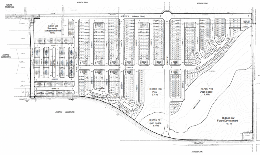
Farther east, plans for the Flato development show Colborne continuing beyond Verulam Road 36 toward Fieldside Road. Although the developer faces financial difficulties, the proposed connection remains part of the area's long-term planning. The bridge could eventually serve neighbourhoods yet to be built.
City staff say traffic signals at Colborne and Road 36 are identified in the city's financial forecast for 2030. How that intersection handles new traffic will become increasingly important as eastern Lindsay grows.
Nearly two centuries ago, John Huston laid out Colborne Street on either side of the Scugog River. Generations have since debated how, where and whether to cross it.
Now, at last, a bridge is taking shape.
Lindsay's experience may offer a path forward for Fenelon Falls, where replacing the Lindsay Street Bridge and planning a second crossing present familiar challenges. It shows that decades of debate and delays need not prevent a project from becoming reality.
For Lindsay, the end of the wait is in sight. The true measure of success will be how well the new bridge serves the people on both sides of the river, connecting neighbourhoods without losing what makes them home.



Leave a Comment
Your email address will not be published. Comments are moderated.